Weather
Access to accurate and up-to-date weather forecast information is essential for safety at sea for all mariners. Towards this end, NavSim introduced a service that allows customers to obtain valuable weather information and display the information right in Meridian and NavSim’s PPU! The NavSim Weather Service is based on GFS model and covers the whole world. Weather forecasts are updated every six hours. Weather files in GRIB and GRIB2 format for predefined regions are downloaded from NavSim’s website and can then be shown in NavCruiser PRO. As well, custom weather regions can be defined by the user by selecting a rectangular region on the chart itself.
Regional Weather
Weather can be shown by region and the user can select what weather feature to display using the Weather Toolbar. The user selects the GRIB file corresponding to the region and can then control the display of the the following weather information types:
- Wind Barbs
- Wind Beaufort Scale
- Pressure Values
- Pressure Isobars
- Precipitation
- Precipitation Values
- Cloud Cover
- Temperature
- Temperature Values
- Friendly Forecast
- Isobars and Barbs
Waypoint Weather
Weather information is available for any route waypoints that are within an imported weather region. The weather information displayed will be the weather forecast for the time anticipated for each waypoint.
Single Weather Point
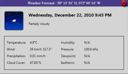
Current weather information can also be shown for a single point.

Single Point Weather


